
Earthquake Hazard Maps
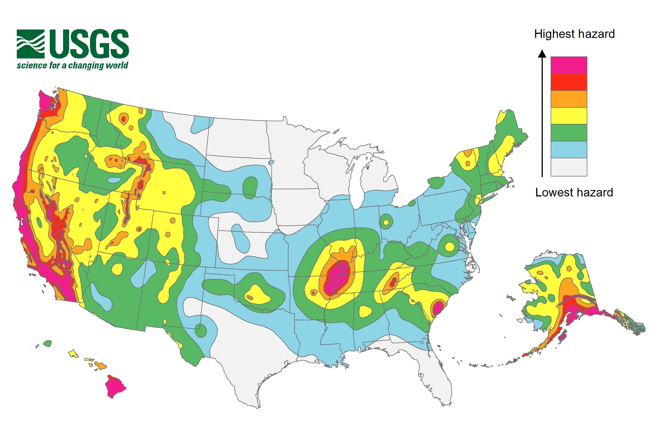 The USGS has released its latest earthquake hazard maps, and parts of Arkansas are within the highest hazard areas. Here's what these maps mean:
What is earthquake hazard?Earthquake ground shaking varies from place to place and the hazard mapping in this project will show this variability. The mapped hazard refers to an estimate of the probability of exceeding a certain amount of ground shaking, or ground motion, in 50 years. The hazard depends on the magnitudes and locations of likely earthquakes, how often they occur, and the properties of the rocks and sediments that earthquake waves travel through.What are hazard maps?The National Hazard Maps show the distribution of earthquake shaking levels that have a certain probability of occurring in the United States. These maps were created to provide the most accurate and detailed information possible to assist engineers in designing buildings, bridges, highways, and utilities that will withstand shaking from earthquakes in the United States. These maps are used to create and update the building codes that are now used by more than 20,000 cities, counties, and local governments to help establish construction requirements necessary to preserve public safety.Learn more at the USGS website. >>